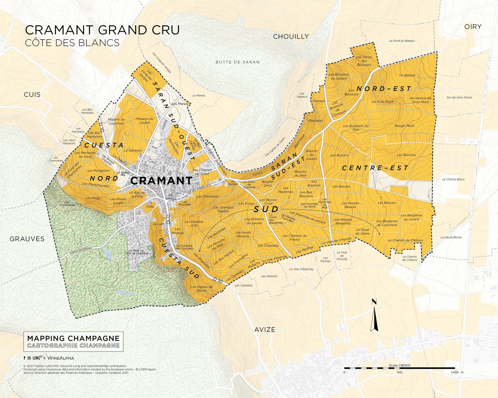
Cramant is a grand cru Champagne village in the district of the Côte des Blancs.
This is one of the first maps in Mapping Champagne, a new series of maps by Steve De Long and Charles Curtis MW. It's the first modern update and expansion of the pioneering work of Larmat, which was done in the 1940s.
The map is accompanied by a bilingual French and English booklet that provides a tour of the village terroir and its unique wines, a complete list of lieux-dits planted (or partly planted) in the commune, and a directory of its winemakers.
The Cramant Grand Cru Map is available as a high quality print, digital download or both.
Please note: all sales are final on digital products.
Cramant is a grand cru Champagne village in the district of the Côte des Blancs.
This is one of the first maps in Mapping Champagne, a new series of maps by Steve De Long and Charles Curtis MW. It's the first modern update and expansion of the pioneering work of Larmat, which was done in the 1940s.
The map is accompanied by a bilingual French and English booklet that provides a tour of the village terroir and its unique wines, a complete list of lieux-dits planted (or partly planted) in the commune, and a directory of its