Using our wine map tube labels, here are our plans for continued mapping of the wine world.
We would love your input.
Current maps (including Germany which we are now putting the final touches on):

Upcoming maps:

We're now committing the resources to complete all of the maps within the next year. To be honest, when we started, we thought it would be much easier. But we haven't compromised accuracy, fact checking or quality in putting our maps together. Thank you for your patience.
Any amount of input on our mapping would be greatly appreciated. To show our appreciation, we're giving away a set of our first six maps. To enter, simply write a response to this blog post. A winner will be chosen at random on Friday, November 15th 2014.
Please have a go at any one, a few or all of these questions:
- Are there any other countries or specific region(s) that you would like to see as well?
- Would you like to see more folded maps? We launched a folded version of our Italian map but the sales were just meh - perhaps because it wasn't in a set.
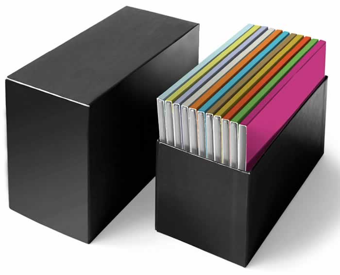
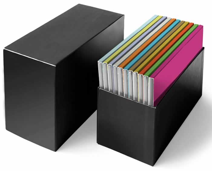
- Would a boxed set of all 12 maps (similar in format to the image below) appeal to you? What would be a fair price for this?
- How about electronic version - Ipad, android tablet - of all of the maps? What would be a fair price for this?
- Our current maps are 24x 36 inches. Would you like to see smaller format maps as well? Larger format?

- Last but not least, would you like to see more countries/regions in David Gissen's amazing Metro Maps Format? In a boxed and/or electronic format as well?

Any input is greatly appreciated. Thank you for your support!


Comments
I would make use of electronic maps that one could take along on an iPad or some other tablet while traveling. We like to visit various wine country while on vacation and being able to refer to the information-filled maps while visiting wineries and vineyards would be great. While I will say that $5/map is a fair price, I would probably pay $10 after a glass or two of wine. Ha!
I’m not a fan of folded maps because it always seems like the info I need is in a crease but a box would probably be a popular item.
Q: Would a boxed set of all 12 maps (similar in format to the image below) appeal to you?
A: Yes! I think it would be great to have more portable versions of these maps. It would also be great if the foldable ones had some sort of laminating on them or was made with the water resistant type paper that hiking maps are (in case wine gets spilled!).
Q: What would be a fair price for this?
A: Depending on the size of each of the foldable maps, perhaps $10-$15 each.
Q: How about electronic version – Ipad, android tablet – of all of the maps? What would be a fair price for this?
A: Yes, please! Perhaps $25 and include access to future maps as well?
Q: Our current maps are 24x 36 inches. Would you like to see smaller format maps as well? Larger format?
A: I think they could be a tad bit smaller for the box set, though it gets hard to see all the details if it is too much smaller. I think the size is great at 24 × 36.
Love the idea of the box set! It will be a real collector’s item, to be taken out at wine tastings and dinner parties. The idea of being able to stow it away in a classy looking and good quality box is very appealing. I would realistically price at ~$15 per map, so ~$150-$180 for a box set of 12 maps seems realistic.
I love the maps! I bought France, Italy, Iberia, and California as soon as they came out. I unroll them at our wine tastings so people can identify the origin of the wine they brought. Great educational tool. Myself, I would not have use for folded or digitized maps but if that is where the market is, go for it. I would welcome a larger format and a $100 for a boxed set is very reasonable.
Suggestion: A lot of research goes into these maps. There is value added there for a companion product like indexes, histories, grape varieties, etc. You probably already have the data. It just needs to be organized into a format that can usefully accompany the maps. I’d pay $200 for that!
I’m a big fan of your work and will continue to support your productions. As an aspiring Sommelier, I would find value in map worksheets of sorts. Perhaps a blank map with a fill in the area with the right matching title. Blank map of Germany with the 13 Aubaugibiete listed off to the side or the regions of Italy and their corresponding main grape varietals. Again, I love the detail and the time you’ve put into your work, keep it up :-)
Steve,
I second the idea of electronic maps in iPad format. If these maps would allow the user to zoom in for more detail on a specific sub-regions that would be even more helpful. With physical maps there is always a limit to the amount of detail you can provide without cluttering up the image. Electronic maps would give you more flexibility. Pricing of $5-$10 per map with updates would be terrific.
I love that you are working on maps; to be truly useful for me, I would need them in PDF or electronic form so I can use them on Android devices. I think a fair price would be anywhere from $9.95 to $19.95 USD.
Personally, the printed form of the maps would be of little use as I am out of wall space to display them :-( But, I do like the set, folded, in a box; that may be useful. Same price?
Maps are a real resource! Electronic maps is what this geneation understands—$5 for one—lesser for more seems like a play. I have a few of the folded maps—dont like them at all but for information they very informatative but hard to open and look at (especially if you have had a glass or two). Suggestion: I would LOVE to have them in a large coffee table book form. Small binders which would allow book to lay flat. A binder would allow you to add more pages as you expand and develop more regional maps and allows you to take out a map easily if you want to look at a smaller region or the map as a whole!Maybe 18x 24? Have the whole map on a page-yes hard to read—BUT blow up the regions on next pages so you can see everything clearly It would be an amazing resource-no more folded lines and it would a beautiful addition to a wine room/school. Cost…hard to say since I dont know what the cost of creating the “book”. If I were you I would sell it intially as the book with the “first region” for a price and then (as in a book club type format) each month I would get a new region (main map and all the blown up regions for another price.) This allows your customers to buy the whole set at reasonable price. So instead of one folded map, you might get “10 pages” of all of Italy and its regions. Make sure it is nice paper quality. The binder book allows your customers to buy additional maps in years to come as you create them or UPDATE older maps. You already have 12 regional maps right now, so I would be buying one a month all year. When I am done- then I would offer metro maps or new regions as you create them. Ultimately, I would be selling the “set” for lots more than $100 which most folks are saying they would pay for the folded set now. Whew!!!Sorry didnt mean for this to be this long!
Congratulations, Steve, on the new website. I have found it as clear and user-friendly as your maps; and I can not at this moment add any suggestions to it, though with further exploration something may show up. You have a wonderful way of tucking in details that only pop up with close inspection – a perfect example is the reference notes that you list for latitude of corresponding wine regions. I just found those as I was going through the collection looking for the date/editions on them; and I laughed out loud when I spied them and recognized them for what they were. That was a delightful surprise.
I treat and use your maps like I do the wonderful books of Jancis Robinson and Hugh Johnson, a constant source of education and entertainment. Thank you again for bring them to market.
On the questions that you pose I do have a number of points for your consideration.
I urge consideration of the area surrounding the Canadian Niagara Peninsula of Ontario along with the nearby AVAs of New York State and Ohio, the VQA of British Columbia, the AVAs of Texas, and finally the wine areas surrounding the Black Sea.
Is there any chance of resurrecting the map of Long Island that you did?
I prefer the 36 × 24 flat format as I enjoy the tactile feel of a map and the ability to get lost in it without any form of electrical current necessary to keep things “alive”.
Folded maps for field use would be welcomed if there could be a tougher paper/media used. I wore out my Italian version after two trips of travel/exploration. How about a lamination option of all the maps to surrplant the framed offering or as an additional method of presentation?
Thanks everyone for both the great feedback and kind words!
As for smaller maps, I was thinking of less detailed country maps showing only the most important regions and regional maps that are more detailed.